MOLINE, Ill. — Editor's Note: This severe threat has ended for the News 8 viewing region.
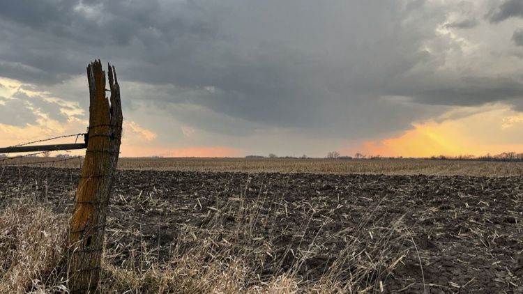
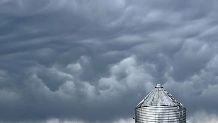
Severe weather swept through western Illinois Tuesday night, with a tornado confirmed in Henry County.
The National Weather Service (NWS) issued a tornado watch for much of the region, including Rock Island County, Whiteside County, Mercer County, Henry County, Bureau County and Stark County. That watch was canceled shortly after 7:15 p.m.
Updates
7:16 p.m. | The tornado watch for northwestern Illinois has been canceled. A tornado was confirmed in Henry County.
6:41 p.m. | The tornado warning for Henry and Bureau counties has been canceled, per NWS Quad Cities.
6:22 p.m. | The tornado watch for the Quad Cities metro area has been dropped.
6:07 p.m. | The storm in Henry County is headed into Bureau County.
6:04 p.m. | A tornado warning has been issued until 7 p.m. in parts of Henry and Bureau counties.
5:57 p.m. | News 8's Chief Meteorologist James Zahara says a tornado has touched down in Atkinson. Those in the area should take cover.
5:51 p.m. | Those in Atkinson and Annawan are asked to take cover as rotation on radar continues to strengthen, per NWS Quad Cities.
5:45 p.m. | A tornado warning is in effect in Mercer and Henry counties.
5:43 p.m. | Severe thunderstorms continue to move east of the Mississippi River over the next one to two hours.
5:34 p.m. | The NWS Quad Cities advises those near Geneseo and the I-80 corridor in Henry County to take shelter.
5:30 p.m. | A tornado warning has been issued for parts of Henry County until 6:15 p.m.
5:14 p.m. | A severe thunderstorm warning has been issued for parts of Whiteside County.
4:58 p.m. | A large portion of Mercer County is under a severe thunderstorm warning until 5:45 p.m.
4:56 p.m. | A severe thunderstorm warning has been issued for the Illinois Quad Cities region until 5:45 p.m.
4:34 p.m | A severe thunderstorm warning has been issued for parts of Henry, Bureau and Whiteside counties.
4:31 p.m. | NWS Quad Cities expects storms to be leaving the area after
4:22 p.m. | Lighting potential in the Quad Cities to Sterling-Rock Falls region is increasing over the next half hour or so.
4:16 p.m. | The NWS storm spotter training class set to be held Tuesday night in Davenport has been canceled due to the weather.
3:53 p.m. | A tornado watch has been issued for numerous counties on the Illinois side of News 8's viewing region, including Scott County in Iowa.
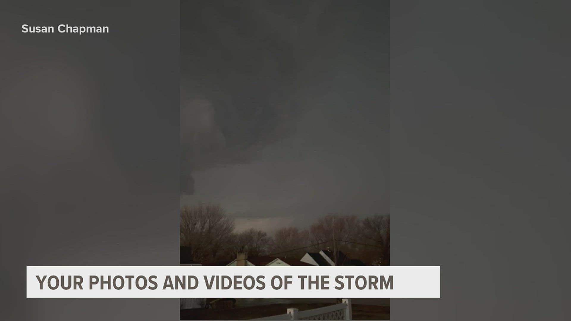
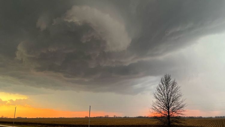
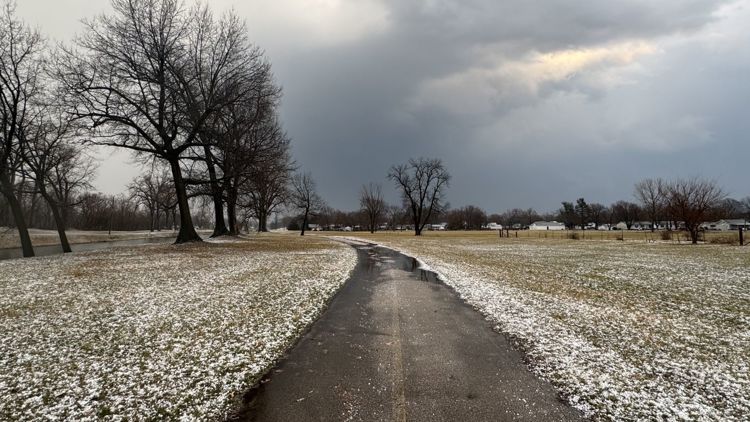
Severe weather hits Quad Cities region Tuesday, Feb. 28


Severe Storm Threat
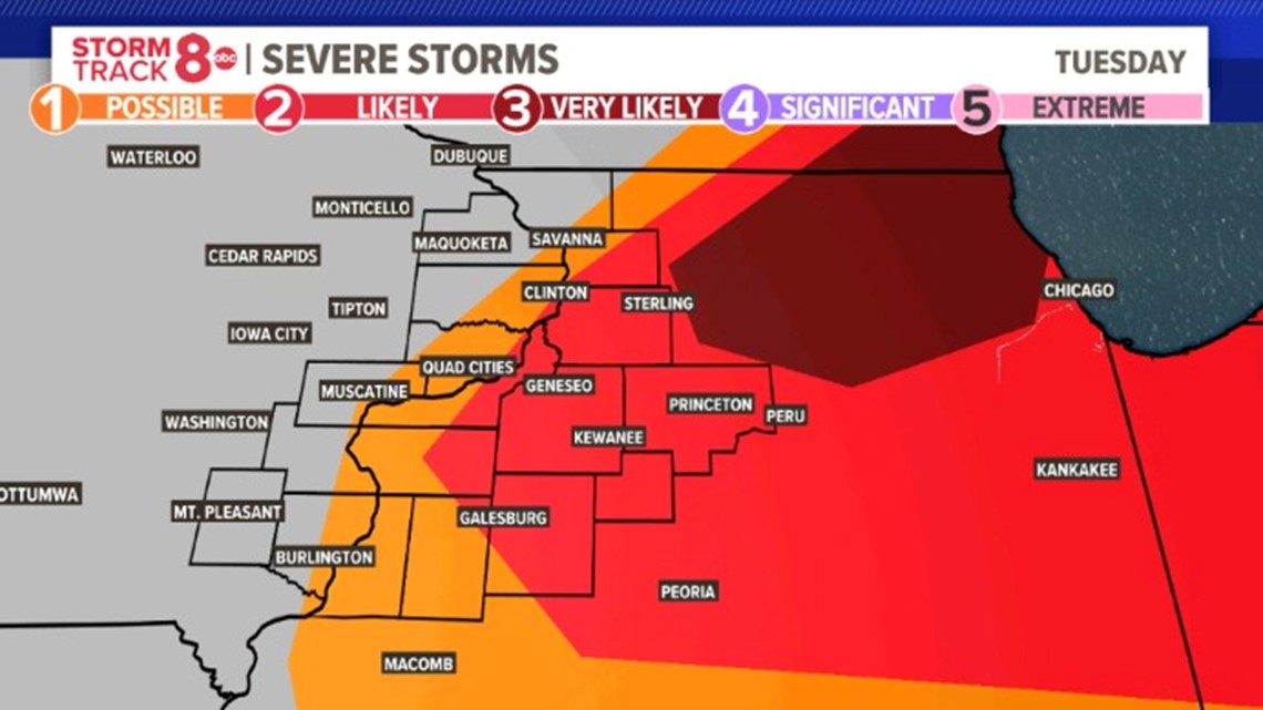
A severe storm threat level of 2 out of 5 has been forecasted for all of Whiteside County, Henry County, Stark County and Bureau County. The same threat level has been forecasted for much of Rock Island County, Knox County, Mercer County and Carroll County.
A severe storm threat level of 1 out of 5 persists for all of the Quad Cities metro area and portions of eastern Iowa, including Clinton, Muscatine and Burlington.

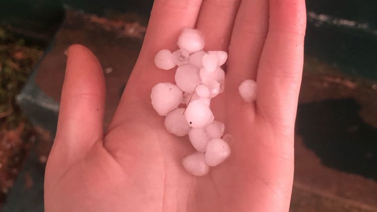
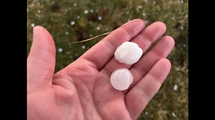
Large Hail Potential
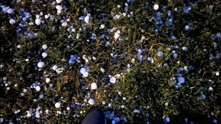
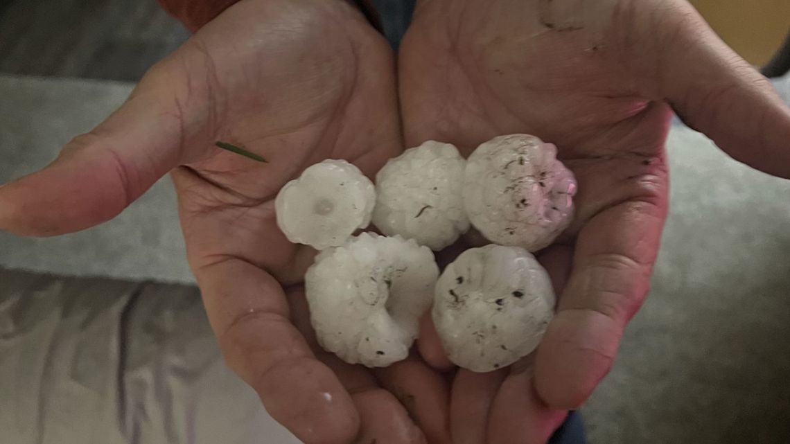
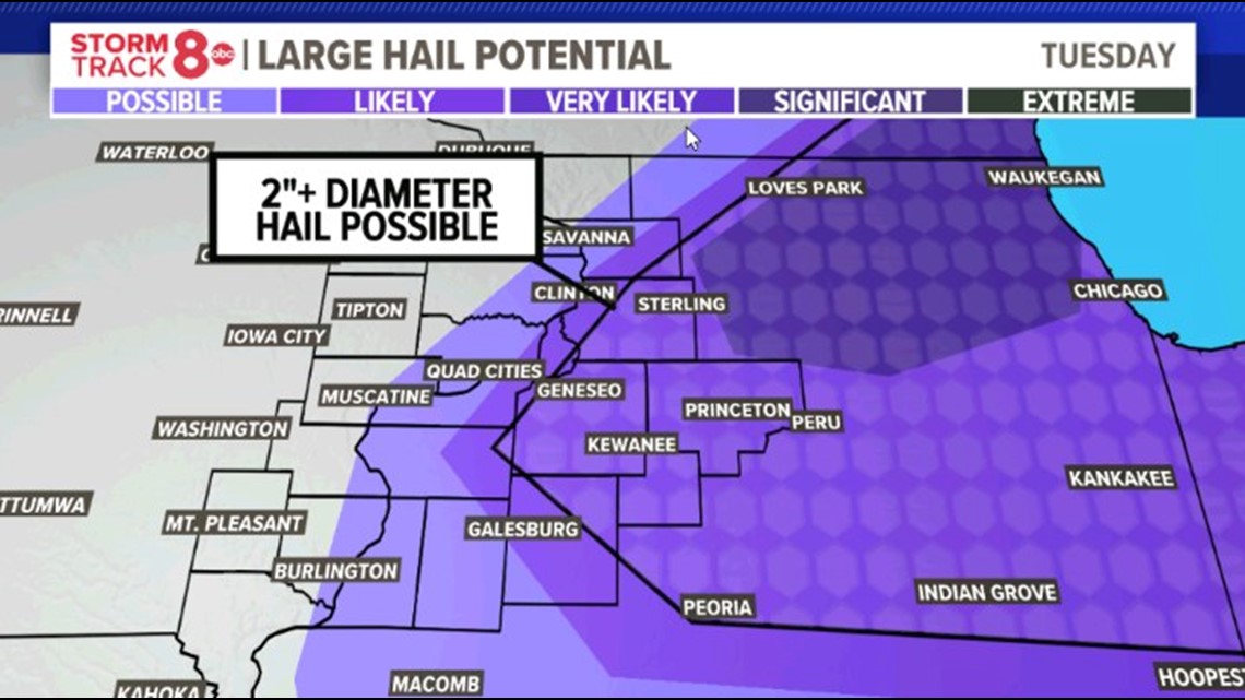
Significant hail potential exists for much of the region, possibly reaching up to two inches in diameter in Rock Island County, Whiteside County, Mercer County, Henry County, Knox County, Bureau County, Carroll County and Stark County.

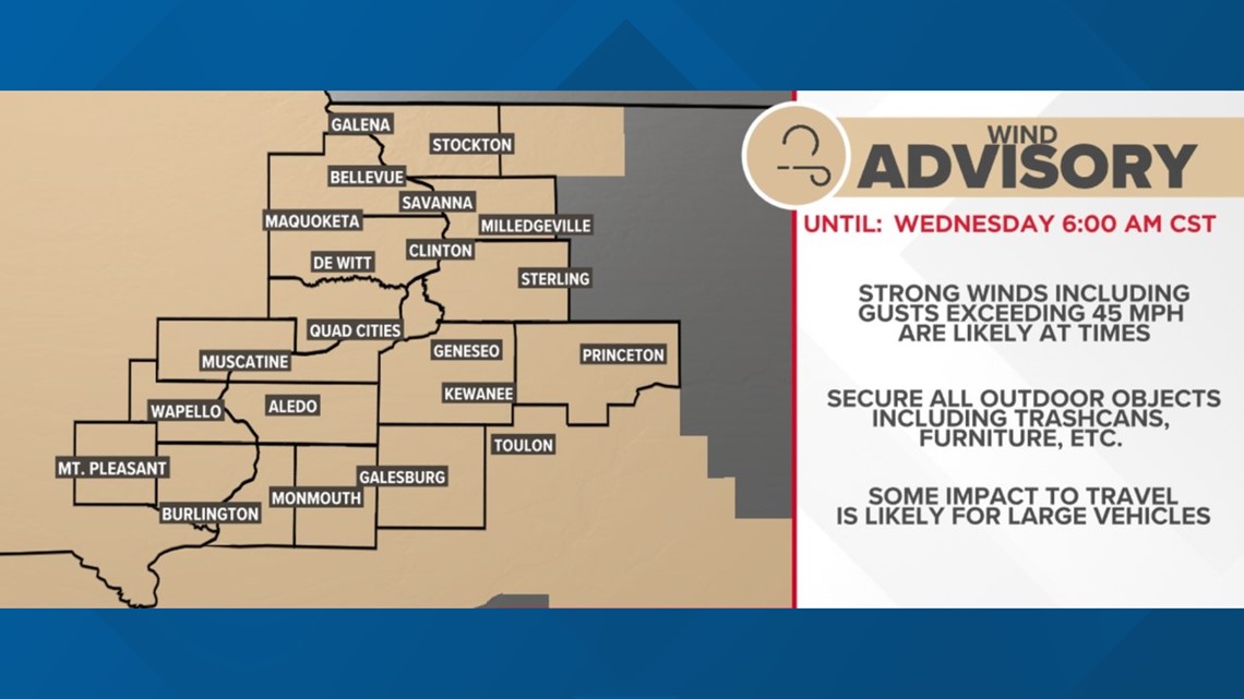
Wind Advisory
A wind advisory has been issued for the region effective until 6 a.m. Wednesday, with wind gusts exceeding 45 mph possible. The advisory is in effect for all of northwestern Illinois and much of eastern Iowa.