Two more storm systems are lined up to bring more rain to the Mother Lode foothills and more snow to the Central Sierra mountains, first Wednesday to Thursday, and then Friday to Saturday.
The first storm could bring 1 to 1.5 inches of rain to the Sonora-Columbia-Angels Camp areas, with winds gusting north from 15 to 20 mph Wednesday, and snow levels starting out around 6,000 feet, then lowering as low as 3,500 feet by Thursday.
The second storm could bring the same amount of rain to the same areas, with snow levels starting out around 5,500 feet and lowering as low as 3,500 feet by Saturday night.
Snow accumulation estimates included 1.5 to 2 feet of new snow for Ebbetts Pass, and 1 to 1.5 feet of new snow for Sonora Pass from the first storm, then 1 to 1.5 feet for Ebbetts Pass and 8 inches to a foot for Sonora Pass from the second storm.
Daytime highs this week in Sonora are expected in the 50s and low 60s. Overnight lows are expected in the mid-30s to low 40s.
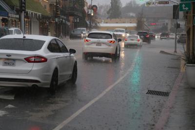
The storm that started Friday evening and continued through Sunday morning brought 3.22 inches of rain to Arnold, 2.41 inches to Avery, 1.92 inches to Columbia and East Sonora, 2.01 inches to Twain Harte and Mi-Wuk Village, and 1.48 inches east of Pine Mountain Lake, according to instruments monitored by the National Weather Service in Sacramento and Hanford.
Instruments monitored by the state Monday showed 1 to 2 feet of new snow at multiple locations compared to last Friday, including current snow depths of 86 inches at Ebbetts Pass, 72 inches at Sonora Pass, 99.3 inches at Tioga Pass, 77.1 inches at Dana Meadows, and 92 inches at the University of California, Berkeley, Central Sierra Snow Lab in Soda Springs.
The statewide average snow water equivalent Monday was 26.5 inches, 102% of normal for the date March 25. In the Central Sierra, the average snow water equivalent was 26.9 inches, equal to 99% of normal for March 25 and 99% of the April 1 average.
Principal reservoirs in Central Sierra watersheds, including Camanche, Pardee, New Melones, Don Pedro, Cherry, and Hetch Hetchy, remained more than 80% full as of Monday.
As of Monday, regional Central Sierra precipitation was at 25 inches for the Stanislaus River and Tuolumne River watersheds since the current water year began Oct. 1, equivalent to 79% of average for the date March 25.
Scientists with the U.S. Drought Monitor said last week that 4.54% of the Golden State — comprising small pockets of land near the Oregon, Nevada, and Arizona borders — was abnormally dry as of last Thursday, and 100% of the state remained drought-free.