A new digital map exhibit, Hidden Landmarks of Albina’s Black Community, highlights some of the most culturally significant buildings in Portland’s Albina Neighborhood.
The historically Black neighborhood, which became an established Black community in the early 20th century, was gutted during the 1960s due to urban renewal projects, including the expansion of Legacy Emanuel Hospital, the Interstate 5 corridor and what is now Moda Center. Hundreds of homes and businesses in Portland’s historically Black neighborhood were destroyed in the process (a federal civil rights lawsuit brought by original Albina residents and their families is moving forward).
Hidden Landmarks of Albina’s Black Community can help Portland residents visualize the vibrant neighborhood, pairing surviving icons with the stories of long-gone buildings. The Skanner News Group office on North Killingsworth Street still stands, for example. But what is now the Leftbank office complex at North Broadway and Wheeler Avenue was once the site of The Dude Ranch, a jazz supper club that operated in the ’40s, owned by Charles “Pat” Patterson, a basketball player for the University of Oregon, and the first Black player in the Northern Division of the Pacific Coast Conference.
The map database, a collaboration between Oregon Black Pioneers, Moreland Resource Consulting, and Restore Oregon’s Albina Preservation Initiative, launched April 18 at the Oregon Heritage Conference in Forest Grove.
“One of the most significant advantages of visiting these maps in digital format is the ease of exploring the sites at your leisure,” MRC founder Kim Moreland writes via email. “You’ll be able to take your time reading the summaries of each site.”
Site guests can browse the exhibit, also called a StoryMap, with an open Google Maps tab to see listed information locations and compare stories of what is and once was. They can also toggle some 3D renderings of those listings, designed by University of Oregon graduate student Matt Kelly.
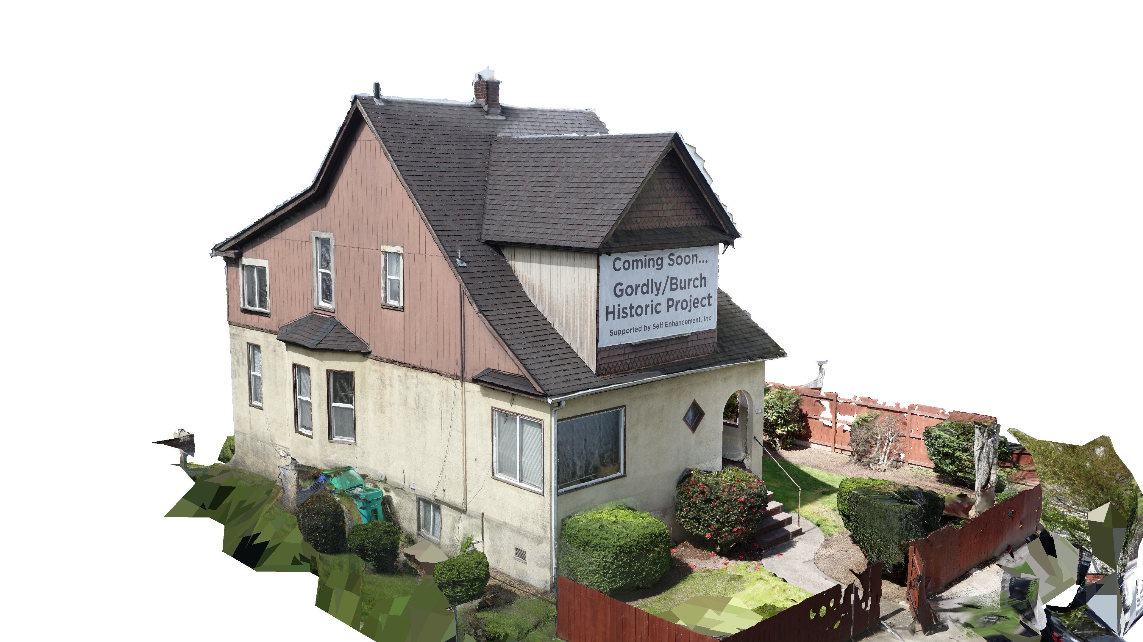
Kelly built exterior models of the First African Methodist Episcopal Zion Church on the corner of Skidmore Street and Vancouver Avenue, the historic NAACP credit union building on North Williams Avenue (now containing Microcosm Publishing), and the Gordly Burch Home, also on Williams, the childhood home of Avel Gordly—the first Black woman to serve as an Oregon state senator—and her sister, activist Faye Burch.
Moreland says the StoryMap’s lesser-known landmarks are being acknowledged publicly for the first time through the exhibit. The Fullilove Home on Northeast Prescott Street, for instance, was home to turn-of-the-century activists James and Mary Fullilove. James served as treasurer of the Afro-American League, while Mary served with the local chapter of the Woman’s Christian Temperance Union.
“New Portlanders will learn more about the rich African American heritage in N/NE Portland,” Moreland writes. “We often use the term ‘historically Black Portland community,’ and users will be able to better understand the geographical boundaries/context of the historically Black neighborhood.”