Colorado Weather: Continued Hot And Dry With Only A Few Afternoon Storms
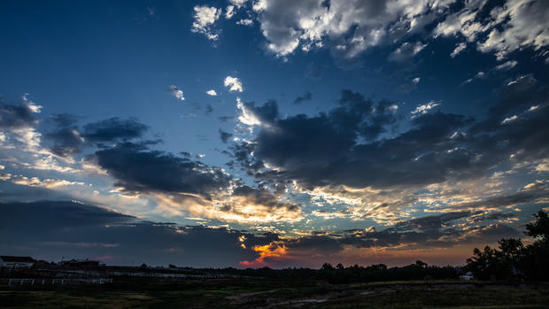
DENVER (CBS4) - It was a quiet start around the Rocky Mountain region this morning with a nice sunrise thanks to some cloud cover on the eastern plains. A weak push of cooler and more humid air from the north overnight helped a few showers and thundershowers pop up Saturday morning in the vicinity of Sterling, Akron, Wray and Holyoke.
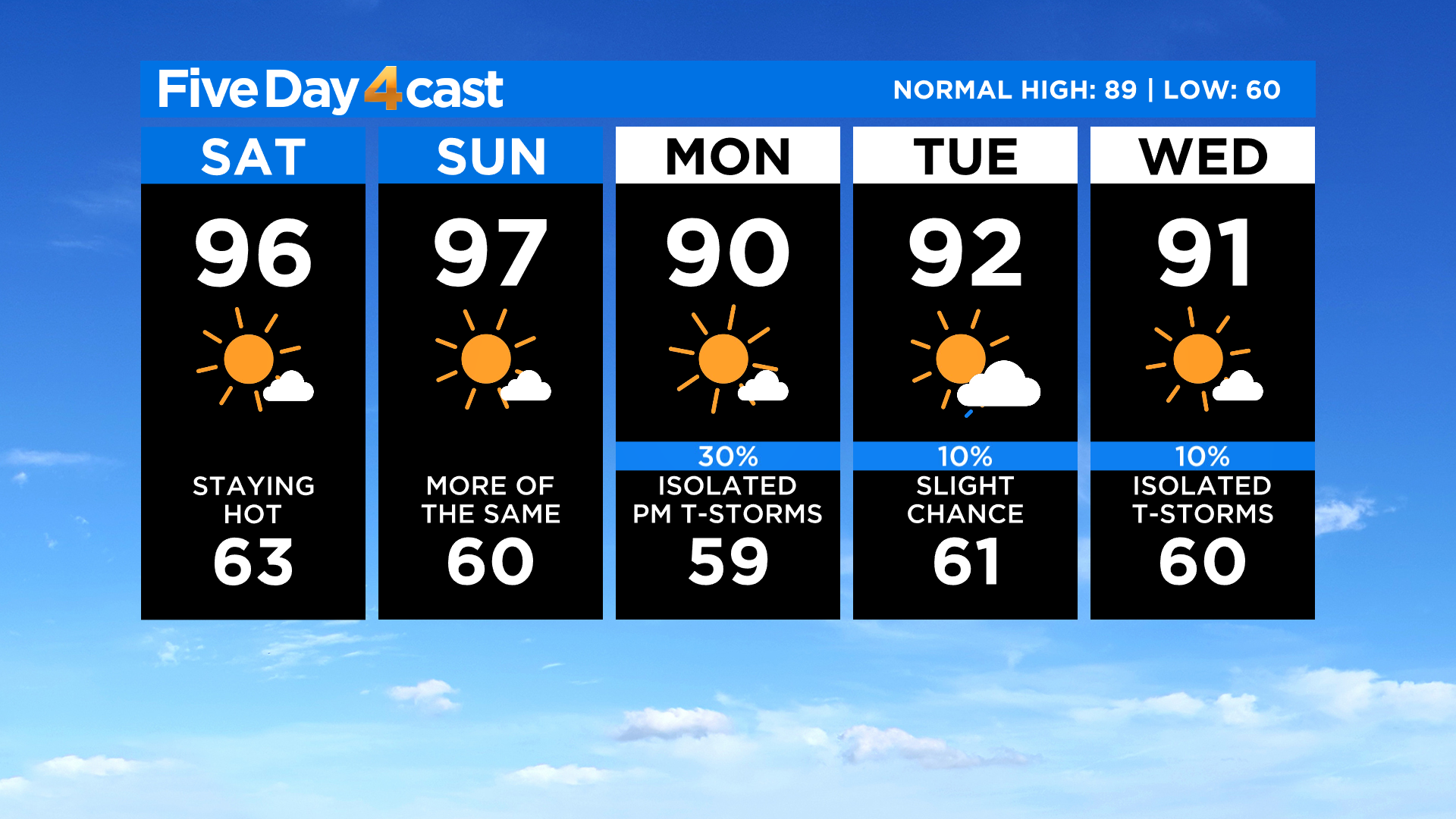
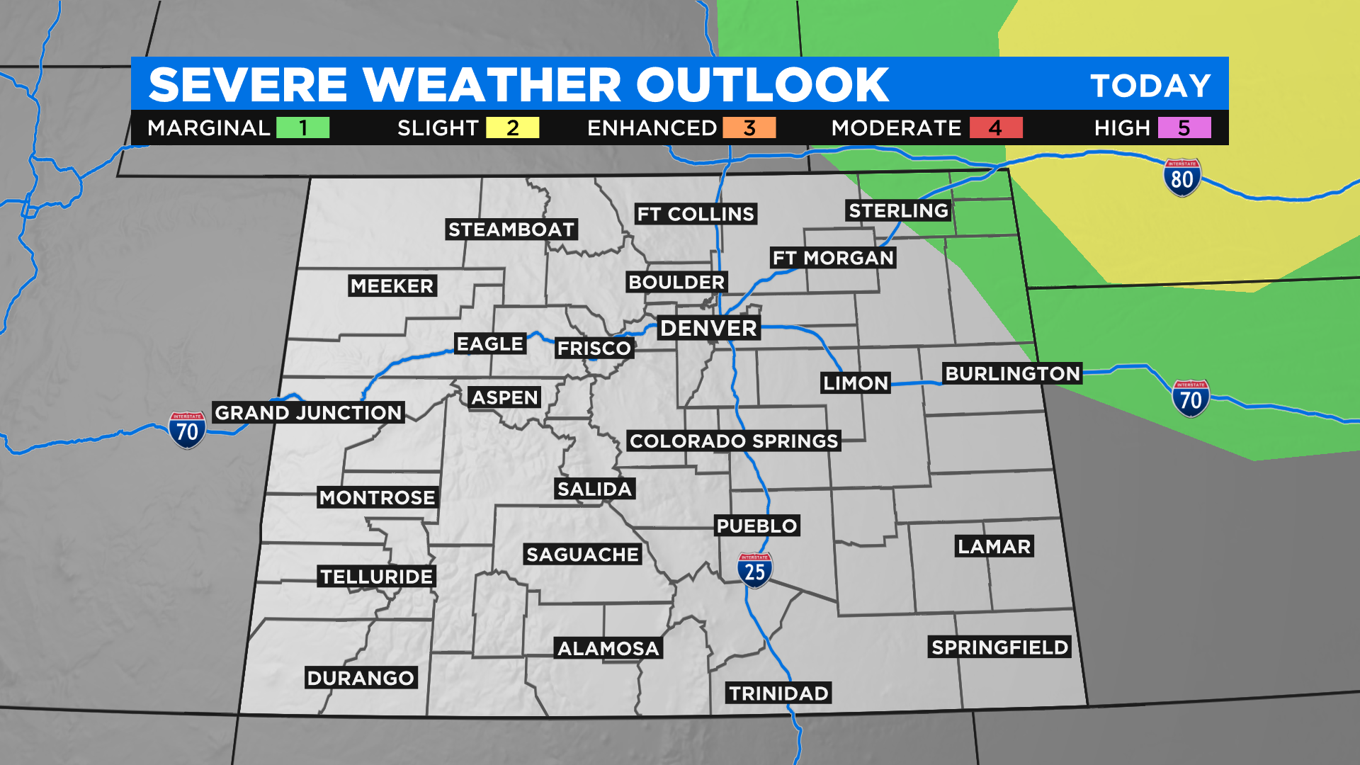
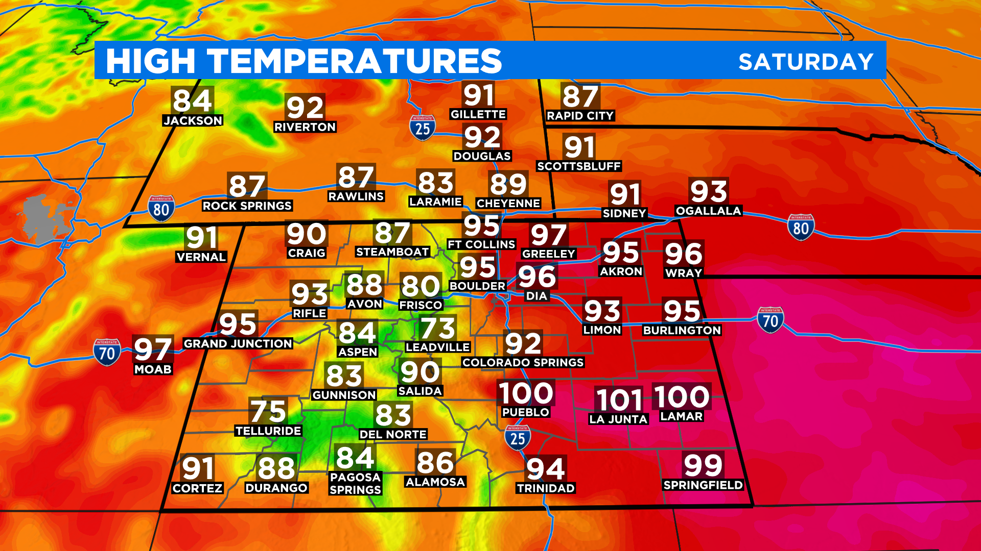
Overall it will be another hot and dry afternoon around Colorado with only a few isolated storms expected. The best chance for those to pop up will be in northeast Colorado and over some of the higher elevations south of Highway 50.
There is a very small chance for a strong to severe storm this afternoon in extreme northeast Colorado. If you are heading into Kansas or Nebraska there is a much higher chance to see some severe weather.
There is a lot of smoke in the atmosphere today from the Pine Gulch Fire near Grand Junction. It is possible to smell and even see this smoke at times today in areas along and north of Interstate 70.
The normal high in Denver right now is in the upper 80s but we will be well into the 90s again by this afternoon. In fact it will be hot statewide with the potential to see a few low 100s on the southeast plains.
Looking ahead it is really more of the same for at least the next 5 to 7 days. A large ridge of high pressure will keep things hot and dry with only a few isolated thunderstorms possible each day. Eastern Colorado should see a slight cool down on Monday.