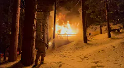
A National Weather Service meteorologist captured a photo of a weather phenomenon after thunderstorms ignited more than 15 fires across Alaska this past weekend.
On Monday, June 2, a NWS forecaster captured a photo of a “smokenado.”
Warm smoke from the fire about nine miles south of Fairbanks combined with the cooler temperatures of the air aloft and created the dust devil, according to KXDF Fairbanks.
“Smoke is almost a perfect way to show the dust devil, because smoke is something you can see and it is easily carried,” Jim Brader, meteorologist with the Fairbanks National Weather Service, told the station. “Large objects like sand are going to fall out as they move up in the dust devil ... but smoke is very light, so it is basically a way to make the dust devil visible.”
Dust devils are common in the area, especially in early summer. Tornadoes, on the other hand, are rare in Alaska, as only four have been reported in the state since 1959, according to the National Oceanic and Atmospheric Administration.
———
©2020 MLive.com, Walker, Mich.
Visit MLive.com, Walker, Mich. at www.mlive.com.
Distributed by Tribune Content Agency, LLC.