

Central Florida to see another round of afternoon storms Wednesday ahead of drier conditions
ORLANDO, Fla. - WHAT IS THE WEATHER FORECAST FOR TODAY AROUND ORLANDO?
Tonight's forecast low: 77 degrees
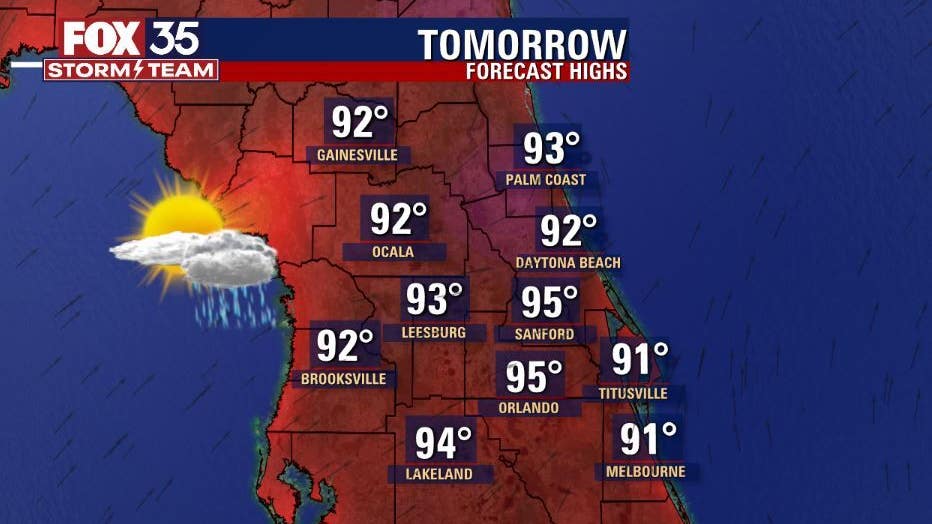
Tomorrow's forecast high: 95 degrees
MAIN WEATHER CONCERNS:
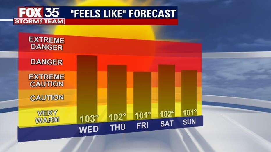
Temperatures will be in the mid-90s across the interior with feels like temperatures soaring to the triple digits. Showers and storms will be at 40% coverage tomorrow afternoon. The west coast sea breeze will be dominating, so shower and storm activity will move east northeast. You can expect frequent lightning, gusty winds up to 40 mph, and heavy rainfall within these storms.
WHAT IS THE WEATHER FORECAST FOR WALT DISNEY WORLD, UNIVERSAL, AND SEAWORLD?
It will be another hot day at the theme parks on Wednesday. Afternoon highs will be near 95 degrees. Showers and storms are possible and the rain will start around 2 pm and will last for a few hours.
WHAT IS THE WEATHER FORECAST FOR THE BEACHES IN CENTRAL FLORIDA?
The shower and storm activity will be moving from west to east across the Florida peninsula, so if you are headed to the Atlantic beaches tomorrow, it will not be until late afternoon when the storms arrive. Lightning will be frequent, so when thunder roars, go indoors. The surf will range between 2-3 feet with a moderate risk of rip currents.
LOOKING AHEAD:
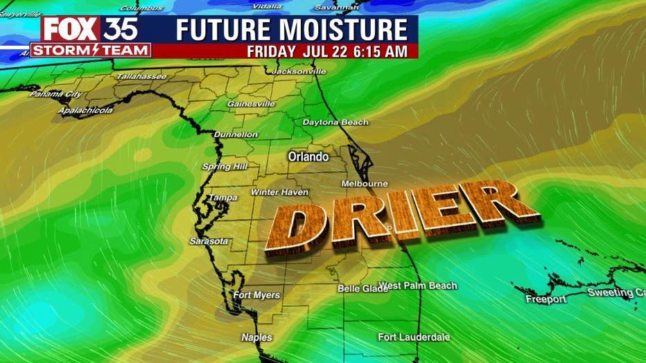
Drier air arrives midweek. Rain chances will drop to 30% coverage on Thursday and Friday. Temperatures will be in the mid to upper-90s throughout the week with feels like temperatures soaring to the triple digits. The tropics remain quiet due to Saharan Dust pushing off the coast of Africa. If anything changes the FOX 35 Storm Team will be the first to let you know.